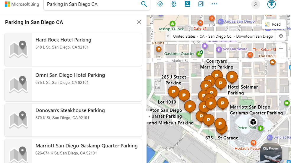
Bing Maps improves trip planning with new distance calculator, gas finder, and parking locator
Just in time for summer trips, Bing Maps has some new features for trip planning.

What you need to know
- Bing Maps has new experiences to help plan trips, including tools for calculating a trip's distance, finding gas stations, and locating parking spaces.
- The service also has a tool for finding feasible routes for travel around obstacles and with various methods of transport.
- Similar features have been available on competing map apps for quite some time, such as Google Maps.
Microsoft has a new set of features for Bing Maps that focus on improving trip planning. Bing Maps now has new experience for distance calculation, locating gas prices, and finding parking spots along a planned journey. Similar features have been available on other platforms, such as Google Maps, for several years, but they have now made their way to Bing Maps.
The tools provide the experience that their names suggest. Distance Calculation calculates the distance of a trip. The Gas Prices feature figures out gas prices on your way. The Parking Finder tool locates parking spaces along your journey. There are some technical aspects of the features that are interesting, such as how Bing Maps figures out the distance of a journey, but those don't affect day-to-day usage. Microsoft explains the features in more detail in a blog post.
A unique aspect of Bing Maps is how its distance by time feature works. When a search is entered into Bing Maps, the service uses Isochrone polygons, as opposed to a circle, to figure out how far someone could realistically get within a set timeframe. For example, I live in Nottingham, England, which is split in half by a river. Because of this, searching for gas stations within a 2-mile radius would normally yield results that were geographically close, but that would take a long time to travel to by car. With Bing Maps, the search would show places I could actually get to in a set time.
The Isochrone API also works with various modes of transportation. Again using Nottingham as an example, there are places it's quicker to get to on foot than by car because of the limited number of bridges that support vehicles.
"This is particularly useful for automotive travelers who are using a map app to find nearby gas stations within a limited travel distance because they are low on fuel. Alternatively, this feature can come in handy for electric vehicle users who are planning trips around charging stations with range constraints in mind," explained Microsoft.
"Support for multiple modes of transportation, including walking, car, and public transportation, means that you’ll always have a tool you can use to navigate, even in an emergency."
Like the other tools announced for Bing Maps, the Isochrone API can be used by developers to create web and app experiences.
Get the Windows Central Newsletter
All the latest news, reviews, and guides for Windows and Xbox diehards.

Sean Endicott is a tech journalist at Windows Central, specializing in Windows, Microsoft software, AI, and PCs. He's covered major launches, from Windows 10 and 11 to the rise of AI tools like ChatGPT. Sean's journey began with the Lumia 740, leading to strong ties with app developers. Outside writing, he coaches American football, utilizing Microsoft services to manage his team. He studied broadcast journalism at Nottingham Trent University and is active on X @SeanEndicott_ and Threads @sean_endicott_.