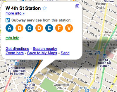
Actually, Google Maps has showed the NYC subway for a while now

You should hear Malatesta's tale about making it to the Oct. 6 launch of Windows Mobile 6.5 with just seconds to spare. It's classic. Especially the part about surviving the dude playing jazz flute. But that's for another time.
Anyhoo, what got him there in time for the keynote was Google Maps, and its inclusion of NYC subway maps. They've been there for a while now, but Google's recently publicly announced them as a feature in the Layers. To turn it on (or just test it if you're outside the city), point the map to NYC, then go to Menu>Layers and turn on the Tranisit lines. Zoom in and you can get station info. It's That simple. [Google Lat-Long blog]
Get the Windows Central Newsletter
All the latest news, reviews, and guides for Windows and Xbox diehards.
Phil is the father of two beautiful girls and is the Dad behind Modern Dad. Before that he spent seven years at the helm of Android Central. Before that he spent a decade in a newsroom of a two-time Pulitzer Prize-finalist newspaper. Before that — well, we don't talk much about those days. Subscribe to the Modern Dad newsletter!
